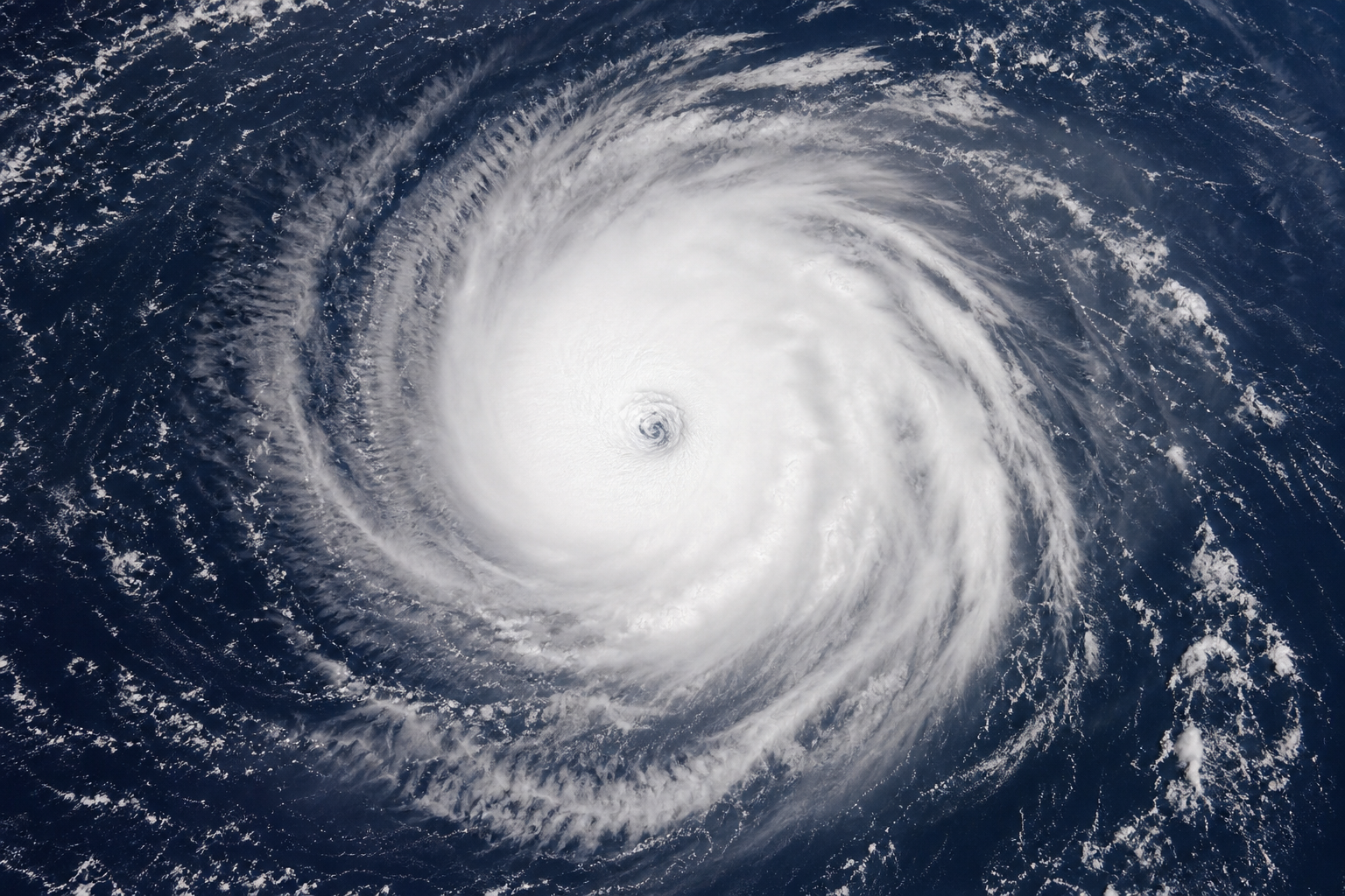
The evidence supports the core forecast: Karina is strengthening over the open eastern Pacific and is projected to become a major hurricane. But “far from land” does not mean no hazard for Mexico’s Pacific coast or Baja California beaches.
Hurricane Karina strengthened over the eastern Pacific on Sunday, August 30, with no forecast landfall and no coastal watches or warnings in effect in the National Hurricane Center’s early-morning advisory. At 8 a.m. Pacific time, the center placed Karina near 17.3 degrees north latitude and 122.1 degrees west longitude, moving west-northwest at 9 mph with sustained winds of 80 mph.
That supports the central claim in reports that Karina is well offshore and forecast to intensify. It needs one important qualification: a storm does not have to make landfall to create dangerous conditions along a coast. The National Hurricane Center says swells from Karina are expected to affect portions of southwestern Mexico and the Baja California Peninsula, where dangerous surf and rip currents are possible during the next couple of days.
For people on land, that is the immediate risk to watch. For ships and anyone operating on the water, Karina’s expanding wind field and high seas are the more direct concern.
What the latest official forecast actually says
Karina became a Category 1 hurricane at 2 a.m. Pacific time Sunday, when the National Hurricane Center estimated sustained winds near 80 mph and located the storm about 820 miles west-southwest of the southern tip of Baja California. Hurricane-force winds extended up to 25 miles from the center, while tropical-storm-force winds extended as far as 230 miles.
The forecast calls for Karina to move generally west to west-northwest over the next several days, taking it farther into the open Pacific rather than toward Mexico or the Baja California Peninsula. The agency’s forecast advisory projected maximum winds of 105 knots, or about 121 mph, by Monday afternoon, August 31. That would make Karina a Category 3 storm, the threshold for a “major hurricane.”
That projected intensity is a forecast, not an accomplished fact. As of Sunday morning, Karina remained a Category 1 hurricane. The National Hurricane Center said environmental conditions and Karina’s inner structure were favorable for strengthening, but intensity forecasts remain less certain than the storm’s broad track. In its advisory, the center noted that average intensity errors are about 15 knots at longer forecast ranges.
Why a distant hurricane can still matter onshore
The phrase “not threatening land” is accurate if it refers to Karina’s core winds and forecast track: the official forecast does not show the hurricane approaching land. But that wording can obscure the separate coastal hazard from waves generated hundreds of miles offshore.
Long-period swells can travel well beyond a storm’s center and produce strong surf and rip currents even when skies near the beach are relatively calm. The National Hurricane Center specifically warned that Karina’s swells could create life-threatening surf and rip-current conditions along parts of southwestern Mexico and Baja California.
That means beachgoers, surfers, boaters and local officials should follow local weather-office and maritime advisories rather than treating the absence of a hurricane warning as an all-clear. A hurricane warning concerns expected hurricane conditions in a defined area; it is not the only measure of whether coastal water conditions are dangerous.
Fact check: what is supported, and what remains uncertain
Claim: Karina is a hurricane well away from land. Accurate. The National Hurricane Center classified Karina as a hurricane early Sunday and placed it more than 800 miles west-southwest of the southern tip of Baja California. Its forecast track keeps the center over open water.
Claim: Karina could become a major hurricane. Supported by the official forecast, with appropriate uncertainty. Forecasters projected peak sustained winds near 121 mph by Monday afternoon, above the 111-mph Category 3 threshold. But changes in storm structure, wind shear or ocean conditions can alter the timing and strength of intensification.
Claim: The storm poses no threat to land. Too broad if it includes all hazards. The forecast does not show a wind or landfall threat from Karina’s center, and no coastal watches or warnings were in effect in the early Sunday bulletin. Yet the agency forecasts hazardous surf and rip currents for parts of Mexico’s Pacific coast and Baja California.
What readers should watch next
The most useful updates will be the National Hurricane Center’s successive advisories, especially whether Karina’s central pressure continues to fall, whether its maximum winds rise toward the major-hurricane threshold, and whether its projected westward track changes.
For coastal residents and visitors in southwestern Mexico and Baja California, the more immediate question is not whether Karina will make landfall. It is whether local beaches, harbors and marine zones face worsening surf and rip-current conditions. Those alerts can change independently of the hurricane’s track.
Karina’s development also underscores why storm categories should be read carefully. Category describes a hurricane’s sustained wind speed near its core; it does not by itself summarize every hazard, including surf, rainfall, storm surge or the reach of rough seas. In this case, the category may rise even as the storm continues away from land—and coastal hazards may persist before the hurricane does.